Maps of countries
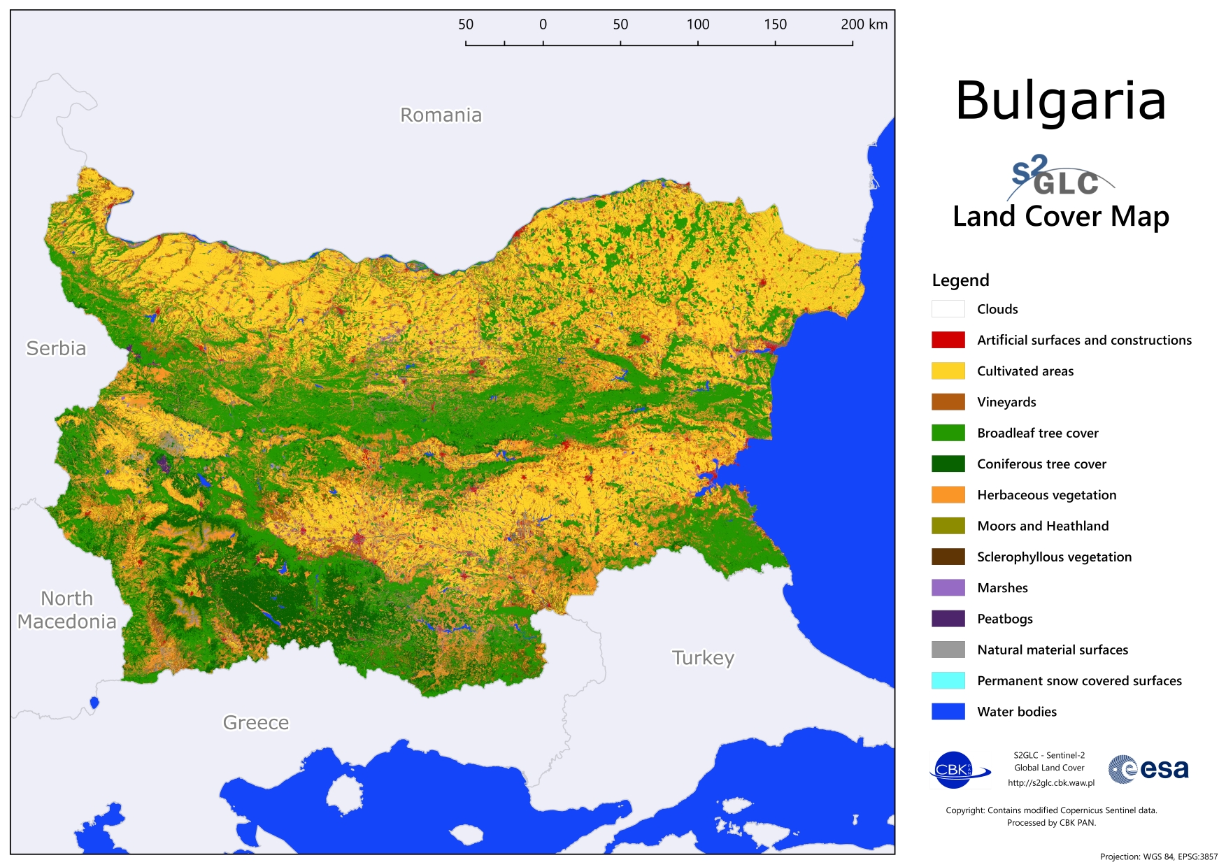
The S2GLC 2017 product is available via CREODIAS (collection: S2GLC) in the form of classified Sentinel-2 tiles. Moreover, CBK PAN has prepared graphics with land cover maps for European countries. Presented graphics do not preserve 10 m resolution of S2GLC 2017 products.
Choose the name of country to download the graphics:
Albania, Austria, Belgium, Bosnia and Herzegovina, Bulgaria, Croatia, Cyprus, Czechia, Denmark, Estonia, Finland, France, Germany, Greece, Hungary, Iceland, Ireland, Italy, Kosovo, Latvia, Lithuania, Montenegro, Netherlands, North Macedonia, Norway, Poland, Portugal, Romania, Serbia, Slovakia, Slovenia, Spain, Sweden, Switzerland, United Kingdom.