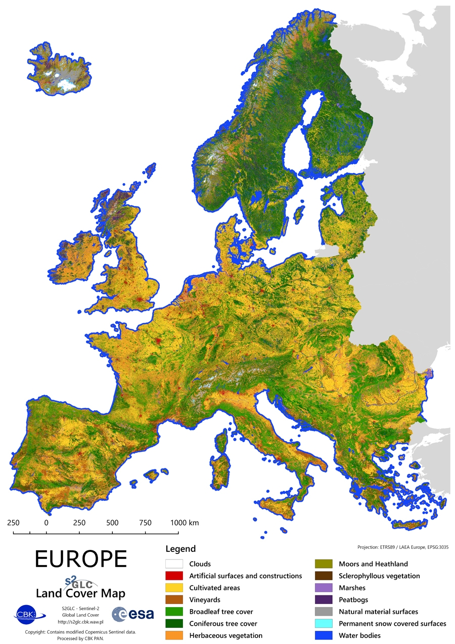
Map of Europe
Land Cover Map of Europe 2017
Overview
The Land Cover Map of Europe 2017 is a product resulting from the Phase 2 of the S2GLC project. The final map has been produced on the CREODIAS platform with algorithms and software developed by CBK PAN. Classification of over 15 000 Sentinel-2 images required high level of automation that was assured by the developed software.
The legend of the resulting Land Cover Map of Europe 2017 consists of 13 land cover classes. The pixel size of the map equals 10 m, which corresponds to the highest spatial resolution of Sentinel-2 imagery. Its overall accuracy was estimated to be at the level of 86% using approximately 52 000 validation samples distributed across Europe.
Data Access
The Land Cover Map of Europe 2017 is available as WMS layer at CREODIAS Browser.
Data in full resolution is available for free in the form of:
- Sentinel-2 tiles (110x110 km each) via CREODIAS Finder (collection: S2GLC)
- single file with mosaic of Europe in one GeoTiff file ~ 8 GB (download)
- single file with mosaic of Europe in one RGB GeoTiff file ~ 16.2 GB (download)
Information about versions: change log
For opening the mosaic files QGIS (open source software) is recommended.
Using data please cite:
Malinowski, R., Lewiński, S., Rybicki, M., Gromny, E., Jenerowicz, M., Krupiński, M., Nowakowski, A., Wojtkowski, C., Krupiński, M., Krätzschmar, E., Schauer, P. (2020), Automated Production of a Land Cover/Use Map of Europe Based on Sentinel-2 Imagery
doi:10.3390/rs12213523
Training data
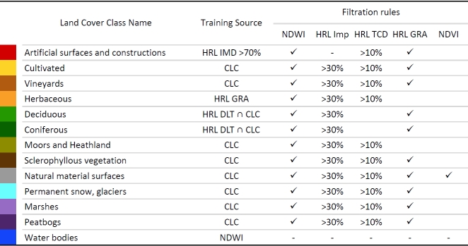
Automatic approach requires automated training data selection. Complex tests resulted in selection of optimal data sources for training. They include Corine Land Cover, Copernicus High Resolution Layers and two spectral indices.
Software and computations
Classification software was developed by CBK PAN. Computation were performed with CREODIAS platform.
Validation
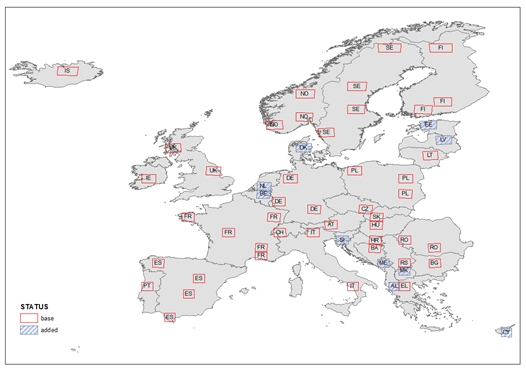
The total number of tiles randomly selected for validation was 55. The total number of randomly distributed samples within these tiles was 52 000. Interpretation was performed by IABG.
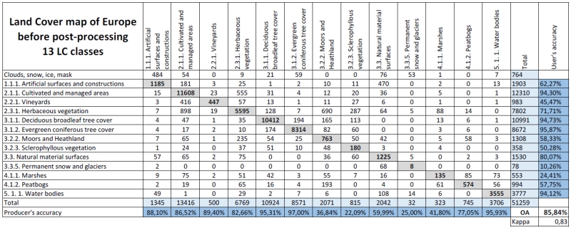
Validation of the map with 13 land cover classes resulted in 86% of overall accuracy:
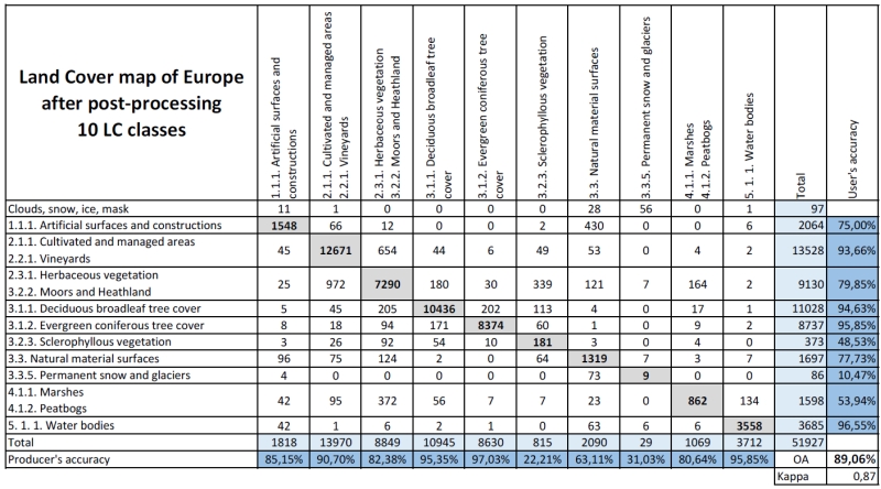
Validation of the map with 10 land cover classes resulted in 89% of overall accuracy:
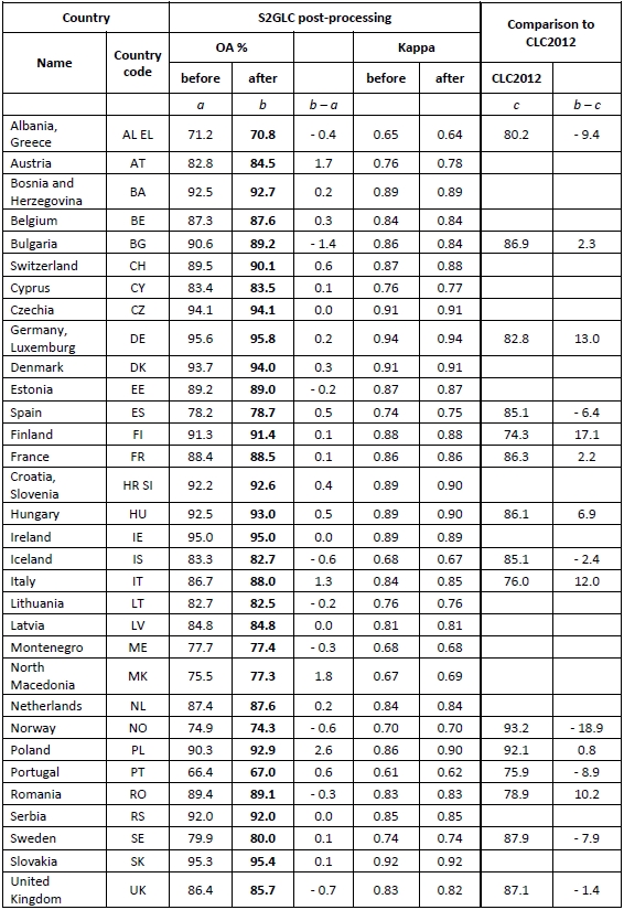
Accuracy assessment per country. Post-processing is the last step of classification process.
Final report from Phase 2 - LINK